400-060-1822

language

Book A Demo

phone
language
以见在线联系
以见在线联系

AR 360 AI Point Cloud BIM 3DGS IoT SLAM

Technological innovation drives engineering data to
be 'more practical''more intuitive' and 'smarter'

BIM+360:

Accurate On-site Recording and Efficient Data Archiving

360 panoramic capture technology captures every detail of the construction site using high-definition panoramic cameras, generating complete digital images

Book A Demo

镜现

Onesight®360 Reality Capture

UPGRADE
产品图

Application Scenarios

Key Features

Capture Device Functions

Capture Preparation

QR code scanning·point selection·camera modes

360° Recording

Real-time path display·CAD path adjustment

360° Video List

Video download · data upload

System Backend Features

Project Management

Team management·data dashboard· project lists·member configuration

360° Viewing

Single-screen browsing·split-screen viewing of BIM + 360° visuals·timeline-based split-screen comparison

Quality Management

Work order creation·message notifications·work order workflow

Hardware Support

360° Panorama Camera

The Insta 360° camera features advanced image sensors, a high-performance processor, and Moonshot AI algorithms, providing clear 360° photos and videos. It optimizes image quality by detecting scene depth and dynamic changes, seamlessly integrating with GIS maps, 3D models, and other data when paired with Onesight®️360· Reality Capture.

Onesight 360 Postion Tracker(PRD)

Integrated with a 3-axis accelerometer, gyroscope, and magnetometer, and powered by the IMUMotionEngine algorithm, it provides precise 3D posture data. It supports automatic indoor positioning and matches seamlessly with BIM models, CAD drawings, and other engineering data.

Book A Demo

BIM+IoT:

Intelligent O&M Inspections and Digital Asset Management

IoT technology plays a pivotal role in the operation and maintenance (O&M) phase of buildings. By integrating smart sensors and devices with building management systems, IoT enables real-time monitoring of key parameters such as temperature, humidity, and air quality within the building. This data provides O&M teams with real-time environmental monitoring and facility management support, ensuring accurate handover of property documentation and assisting property managers and maintenance teams with daily asset and equipment inspections. The result is faster repairs and efficient digital O&M management, driving long-term ESG development.Currently, we support IoT sensor data integration via protocols such as HTTP, WebSocket, and MQTT, along with a 3D spatial mapping tool based on BIM models.

As-built model
verification

Visualization of
concealed works

Building operation data
visualization

Maintenance and repair
feedback tracking

运维助手

Onesight®AR·Operation Assistant

产品图

As-Built Model Maintenance
Concealed Engineering Visualization

View concealed engineering on mobile devices, enabling quick location and model loading for underground pipelines and hidden equipment.

Digital Asset Management
Component and Equipment Visualization

Link BIM components and equipment models with documentation for easy access, reducing reliance on specialists.

施工方

Inspection & Maintenance
Hazard Detection, Work Order Creation

Use AR to identify hazards, create work orders, and track progress. Integrate with third-party systems to manage asset consumption.

Point Cloud & 3DGS

Reverse Modeling and Existing Asset Renovation

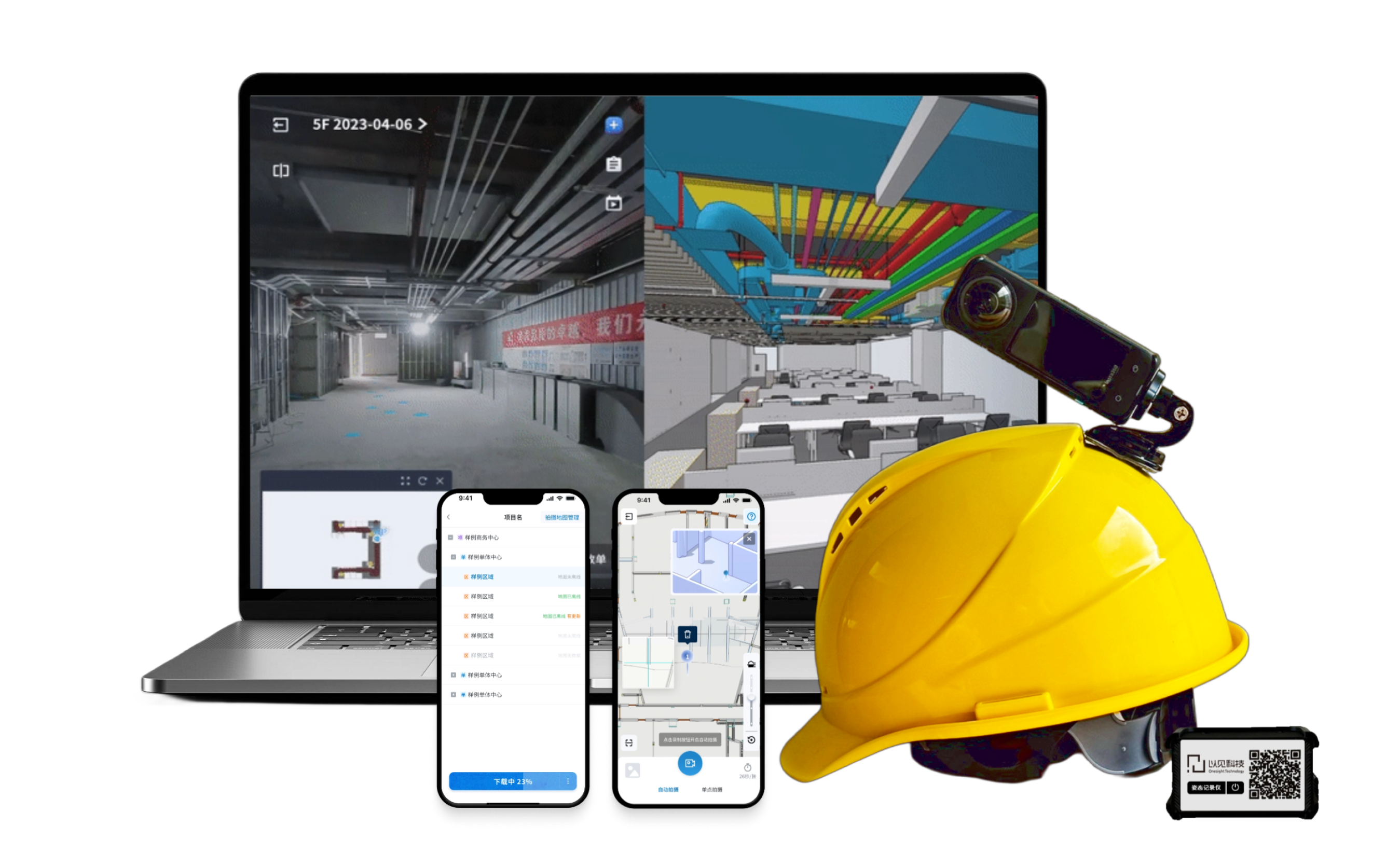
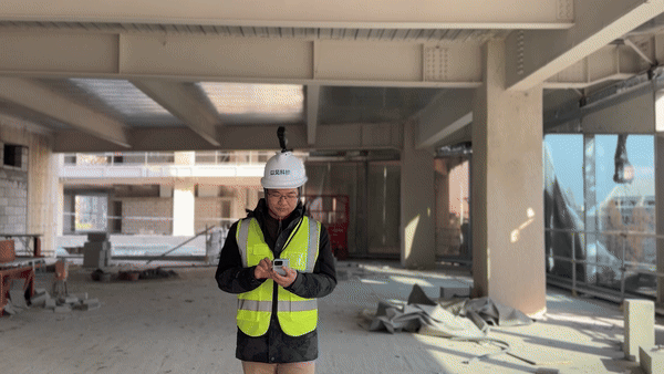
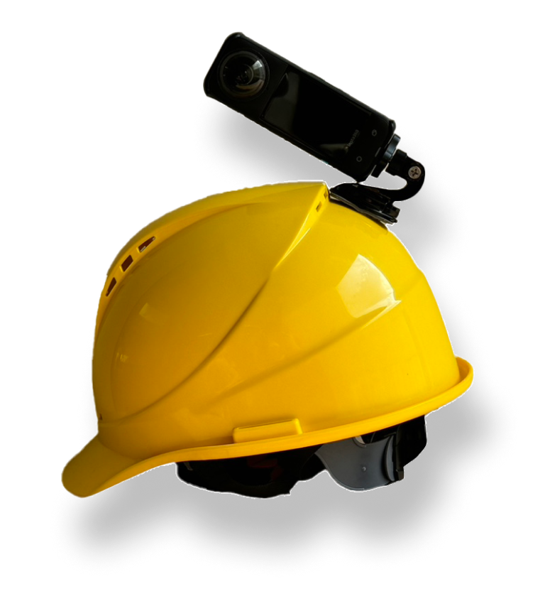
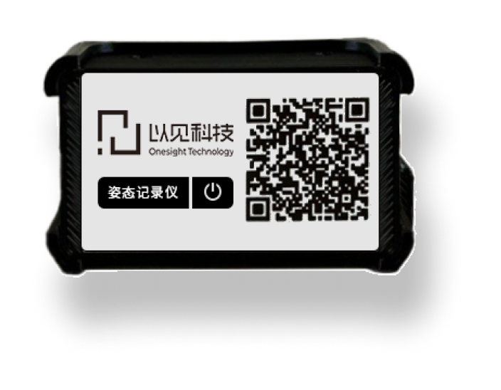
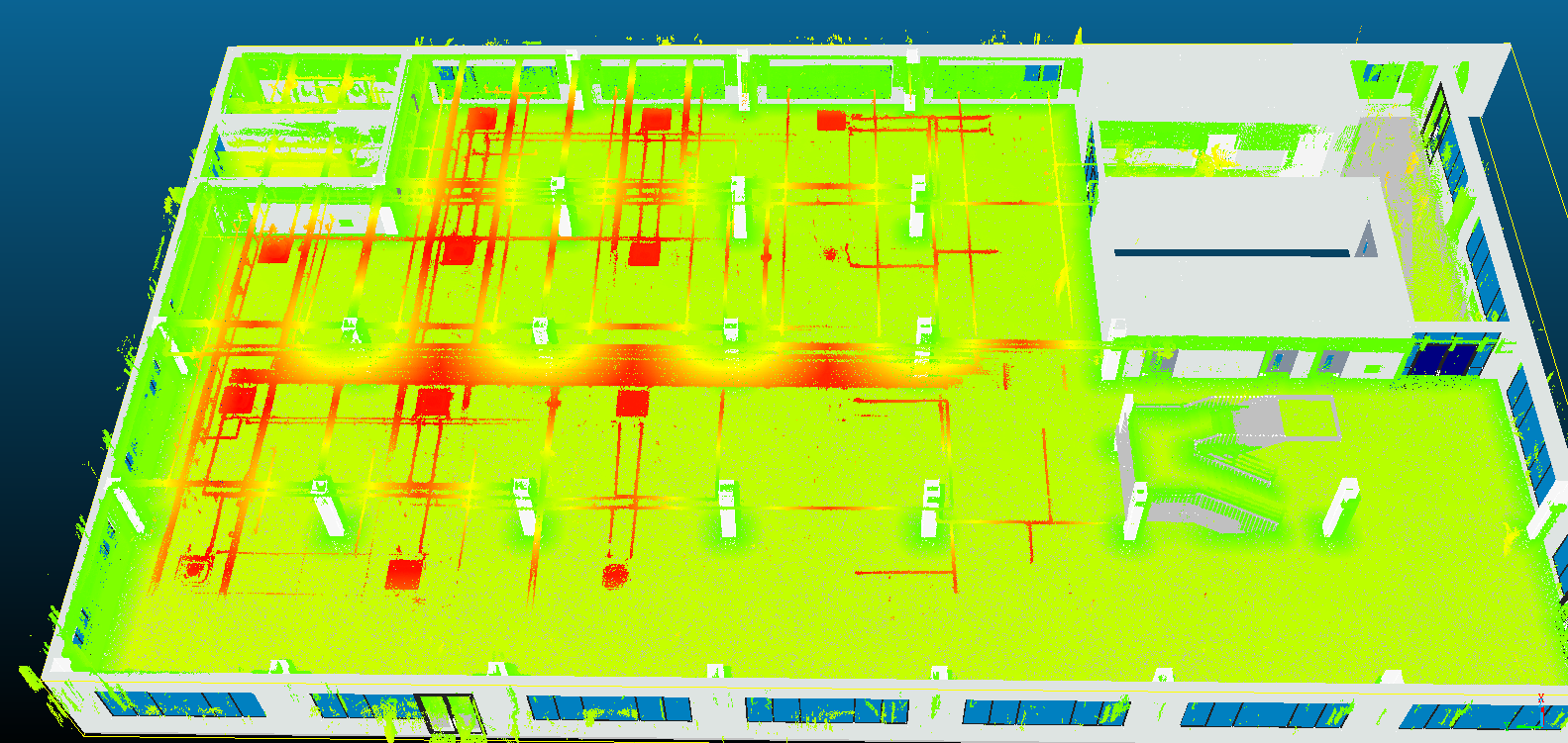
Using panoramic capture devices or handheld LiDAR equipment, data such as photos, videos, or specific formats can be collected to generate 3D Gaussian splat data through NeRF and 3D Gaussian function methods. This serves as a critical data foundation for BIM model repair and reconstruction. In new construction or renovation projects, point cloud data can act as a precision verification tool for BIM models. This 'Point Cloud + BIM' verification method enhances construction accuracy, reduces errors, and prevents costly rework and resource waste.At present, Onesight supports the import of point cloud data from both domestic and international hardware, with compatibility for multiple file formats, including PLY, PCD, RCP, e57, and RCS.

Reverse modeling

Model repair

Existing asset renovation

Digital archiving

产品图

Point Cloud Navigation | Real-Scene Reconstruction
as the First Step in Reverse Modeling

Point cloud technology generates a 3D scene that accurately reflects the actual state of a construction site or existing building. This provides an authentic and detailed 3D environment for teams to visualize and analyze. The point cloud data can then be converted into editable geometric models for further refinement.

3DGS + BIM Comparison |
Deviation Detection and Verification

By overlaying 3DGS point cloud data with the BIM model from the design phase, deviations can be quickly identified. This process aids in the calibration and repair of BIM models, ensuring accuracy throughout the project lifecycle.

Book A Demo